Construction Aviation & Drone Services in Zambia
Drone mapping and aerial survey services for construction in Zambia, including progress monitoring, topographical support and 3D site visibility.
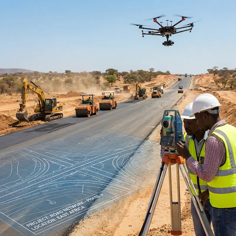
Sector overview
Practical aerial capability for construction teams.
Construction projects depend on accurate site visibility, progress tracking and communication between field and management teams. Drone mapping helps make that visibility faster and easier to share.
Zambia operating context
Dragonfly connects industry support with location-specific pages for Lusaka, Ndola, Chipata and Livingstone, helping search visitors find relevant local services faster.
Discuss your operating areaCommon challenges
The problems these services are designed to reduce
Operational outcomes
What teams can gain from stronger aerial visibility
Recommended services
Services most relevant to construction
Drone Services
Advanced aerial solutions using state-of-the-art UAV technology for mining, agriculture, and surveying.
Explore serviceLand Survey & Mapping
Accurate topographical maps and orthomosaics for construction and development.
Explore serviceNon-Destructive Testing (NDT)
Industrial equipment inspection services ensuring integrity and safety without damage.
Explore serviceDeliverables
Concrete outputs for decision-makers and field teams.
Industry pages now show what buyers can actually expect, which is stronger for SEO and more useful for conversion.
Topographical mapping
Progress imagery
3D model support
Inspection records
Next step
Scope an aviation or drone solution for construction.
Construction Questions
Useful context before contacting Dragonfly Aviation.